
As the Kingfisher jet pushed its way up through the humid, gray air of Delhi, we watched the colorful streets of the city fade and the vast north Indian plain open below us. The flight south to Chennai was a chance to see India from yet another perspective.
The mark of humanity on the land was always visible, but the bones of the Earth show through the thin veneer. The dominant geological features in the north are rivers and streams meandering across the flat brown surface. They appear as thin threads of blue with sandy point bars too large for their current flow in this dry season. The floodplains, which are generally marked by the width of the meanders, are very large, in some cases intersecting so that vast regions must be under water during the monsoons. Agricultural plots cling to the sides of the water courses and extend outwards, following the fertile soil deposited in high water times.
As we crossed over more hilly country, the number and size of the farmed areas diminished and numerous lakes began to appear, almost all with a visible dam which trapped the waters in long, narrow valleys. Small villages could be seen below the dams in the original river channels.
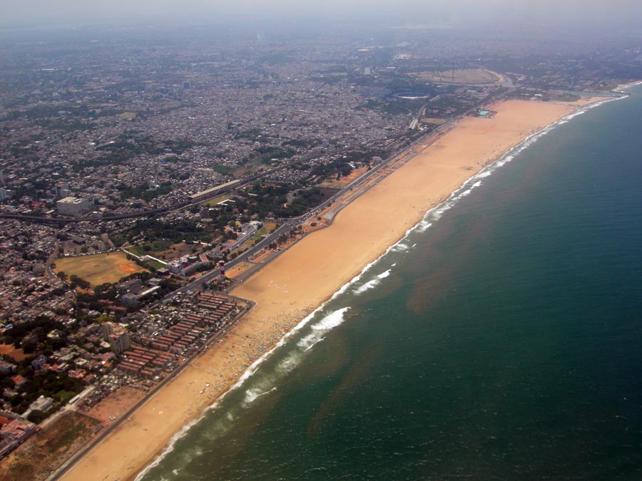
During our descent into Chennai we passed over low mountains covered with deep green vegetation and punctuated by sharp white cliffs. When we crossed the coast of the Indian Ocean a large sandy beach stretched below us with a few tiny dots representing people walking the shore in the noonday sun. The longshore current was visible as a brown streak of water clinging to the shore and moving north Long stone groins stretched perpendicular to the shore to retard the flow of sediment into Chennai’s main harbor.
Leave a Reply